/1004/site-assets/phone.png)
/1004/site-assets/cart.png)
/1004/images/1200958.jpg "Santa Barbara 3D Nautical Wood Chart")
/1004/images/1200957.jpg "Santa Barbara 3D Nautical Wood Chart - Detail")
/1004/images/1200953.jpg "Santa Barbara Nautical Wood Chart - Gray Frame")
/1004/images/1200954.jpg "Santa Barbara 3D Nautical Wood Chart - Gray Frame Detail")
Santa Barbara / Channel Islands Wood Chart
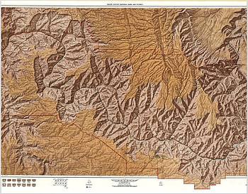
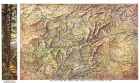
Santa Barbara / Channel Islands Wood Chart: Celebrate the breathtaking beauty and rich history of California's coastline with this Santa Barbara / Channel Islands Wood Chart. This stunning 3D nautical wood map captures the essence of the region, offering a unique and artistic representation of the area's waterways and geographical landmarks. Nestled along California's central coast, Santa Barbara is known for its Mediterranean climate, historic Spanish architecture, and stunning views of the Pacific Ocean. The nearby Channel Islands, a remote archipelago, are renowned for their pristine natural environment, protected as part of Channel Islands National Park. The islands boast a rich history, from Chumash Native American heritage to the era of ranching and maritime exploration. The Santa Ynez Mountains, rising behind Santa Barbara, provide a dramatic backdrop and are part of the Los Padres National Forest, a vast expanse of wilderness stretching through the region.
Santa Barbara / Channel Islands Wood Chart points of interest include: Santa Barbara's coastline, with its golden beaches and historic pier, is beautifully depicted alongside the rugged beauty of the Channel Islands National Park. The chart highlights the significant islands of Santa Cruz and Santa Rosa, each with unique ecosystems and histories. Catalina Island, known for its vibrant marine life and historic Avalon, adds a touch of adventure. Santa Monica Bay, Ventura, and the scenic landscapes of Simi Valley and Las Padres National Forest complete the tableau, showcasing the diversity of this coastal paradise.
Santa Barbara / Channel Islands Nautical Wood Chart color options: Choose between a Dark Brown Frame with Greenish Blue Water for a rich, classic look, or a Rustic Grey Frame with Greyish Blue Water for a more contemporary feel. Each option complements the intricate detailing and natural beauty of the chart, making it a perfect addition to any home decor.
Price each
| Photo | Description | SKU | Units | Price | Qty | |
|---|---|---|---|---|---|---|
/1004/images/1200958.jpg "Santa Barbara 3D Nautical Wood Chart")
|
Santa Barbara / Channel Islands Wood Chart - 20" x 16" / Dark Frame | MINSB |
$169.00
|
|
Add to cart
|
|
/1004/images/1200955.jpg "Santa Barbara 3D Nautical Wood Chart - Gray Frame")
|
Santa Barbara / Channel Islands Wood Chart - 20" x 16" / Gray Frame | MINSBGF |
$169.00
|
|
Add to cart
|
|
| You Might Also Like: | ||||||
| Photo | Description | SKU | Units | Price | Qty | |
/1004/images/1192611.jpg "Southern California Wall Map with Shaded Terrain Relief by Raven Maps")
|
Southern California Wall Map l Raven Maps 33" x 64"|Laminated |
RAVSCaliL |
$75.00
|
|
Add to cart
|
|
/1004/images/1185124.jpg "Santa Barbara 1877 Antique Map Replica")
|
Antique Map of Santa Barbara, CA 1877 36" x 25" |
KROLCSANTB1877 |
$34.95
|
|
Add to cart
|
|
/1004/images/1188619.jpg "California Coast Woodchart 3D")
|
Los Angeles to San Diego Wood Chart Los Angeles to San Diego Wood Chart - 24.5" x 31" / Dark Frame |
MINLASD |
$332.00
|
|
Add to cart
|
|
/1004/images/1193957.jpg "Los Angeles to San Diego Woodchart Gray Frame")
|
Los Angeles to San Diego Wood Chart Los Angeles to San Diego Wood Chart - 24.5" x 31" / Gray Frame |
MINLASDGF |
$332.00
|
|
Add to cart
|
|
/1004/images/1195393.jpg "Channel Islands National Park Dive Map by Franko")
|
Channel Islands National Park Map by Franko 21" x 14" |
FMLCACINP |
$7.99
|
|
Add to cart
|
|

/1004/site-assets/dateseal.jpg "Serving Seattle since 1950")
/1004/site-assets/creditcards.png)